




Food Needs from Nepal’s Glacial Lake Outburst Flood
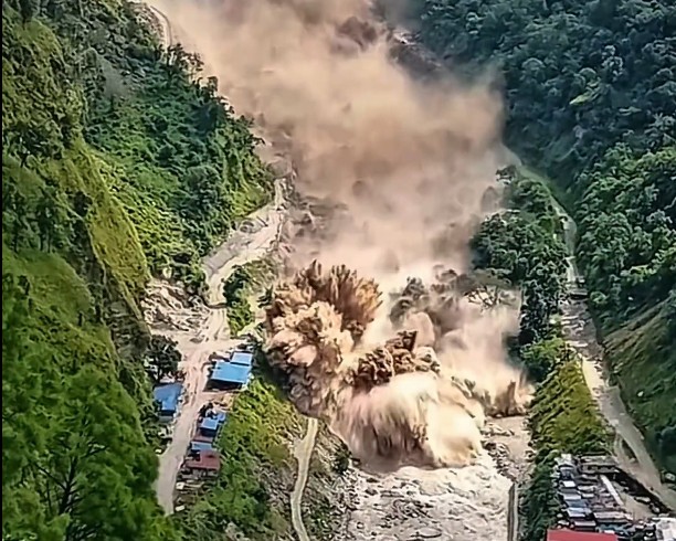
September 1, 2026 The large flash floods that tore through the Himalayas on August 26, 2026 killed over 1,000 Nepalese, with another 5,000+ people missing. Triggered by a catastrophic high altitude mountain collapse along the border of Nepal and China, a towering wall of ice, boulders, and mud cascaded down narrow valleys, completely overwhelming the Bhote Koshi and Trishuli rivers. As search and rescue operations continue. Entire villages have been buried under thick mud, and massive infrastructure projects, including the Upper Trishuli 1 Hydropower Project where hundreds of workers are trapped, have been severely damaged or destroyed. More than 900 workers in hydropower plants are unaccounted for as rescue teams combat tough terrain, difficult weather, and flood waters to try to find survivors following last week’s devastating flash flood. Many of the hydropower workers are feared trapped in the tunnels and underground areas of 11 facilities in the region.
Unlike a classic glacial lake outburst flood, which typically occurs when a slowly expanding pool of meltwater eventually breaches its natural moraine dam after weeks or months of visible pressure buildup, this event was triggered by a sudden and massive ice and rock avalanche. Glaciologists note that high altitude ice and rock avalanches release significantly more kinetic energy in a matter of seconds, acting instantly to pulverize rock and collect immense volumes of debris as they plummet into river valleys. This mechanism creates a very concentrated slurry of mud and boulders that causes far greater and more immediate (sudden, without warning) destruction than typical water floods.
The disaster began when bedrock gave way below a mountain glacier near the Langtang Lirung peak in the Himalayas. Part of this glacier, measuring almost a mile, split off from the mountain. Then, this fast-moving flood raised water levels along downsream rivers by 9 meters.
In recent years, Chinese and Nepalese scientists collaborated to build a cross border monitoring network designed to track glacial lakes and issue alerts. This system had successfully issued warnings for previous hazards, yet it missed the August 26 catastrophe. Researchers now understand that the existing water level monitors were primarily optimized for detecting gradual monsoon floods or perennial river swells. When the ice avalanche struck, the upstream monitoring stations in Nepal were instantaneously swept away by the force of the debris before a single alert could be transmitted. Mountain hazards experts have pointed out that even in a theoretical scenario where sensors remained intact, detecting an ice and rock avalanche upstream would provide a maximum of only twenty minutes of warning to the communities below. The disaster highlights a critical need to overhaul early warning systems in fragile mountain ecosystems.
In the immediate aftermath of the disaster, the Nepali Red Cross stepped up as a leader in the emergency response. Coordinating the national humanitarian effort, the organization has led search and rescue operations across the hardest hit areas like the Rasuwa and Sindhupalchok districts. The Nepali Red Cross estimated that the catastrophe has severely affected as many as 93,000 people, leaving a vast population in desperate need of assistance. First responders from the organization have been working around the clock to establish emergency camps, providing displaced families with support, emergency shelter, and sleeping mats. Furthermore, the Nepali Red Cross has emphasized the immense psychological trauma inflicted upon the survivors, many of whom witnessed their families and homes swallowed by the earth in mere seconds. The organization is also actively monitoring the landscape for secondary flood risks, as natural debris dams created by the avalanche threaten to burst and unleash additional water on the already decimated downstream villages.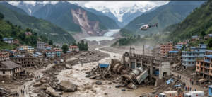
The needs of the survivors in terms for food aid is challenging given the geographical isolation caused by the flood. With at least 19 bridges and nearly 40 kilometers of vital roadways swept away by the surging rivers, traditional supply trucks cannot reach the most needy populations. Consequently, aid agencies are relying heavily on helicopters to airlift emergency food supplies, a method that is slow, expensive, and frequently disrupted by the unpredictable Himalayan weather patterns.
Before the flood waters ever rose, Nepal struggled with significant gaps in public nutrition. According to data from the World Food Programme, approximately 25 percent of children under the age of five in Nepal suffer from stunting due to chronic malnutrition. Vitamin and mineral deficiencies remain widespread, with an estimated 43 percent of children under five being anemic from dietary iron deficiency.
The U.N. World Food Programme has rapidly mobilized its resources, dispatching specialized nutrient packed ready to eat food rations to the hardest hit areas. Because the displaced families have lost access to cooking facilities, cooking fuel, and clean water, standard rations of dry rice or lentils are currently useless to them in the immediate term. Instead, aid workers are distributing high energy biscuits that are fortified with essential vitamins and minerals.
Catholic Relief Services has mobilized its teams to provide emergency food, shelter, and water sanitation support to displaced families across multiple districts. Catholic Relief Services (CRS) and Caritas Nepal, who have already transported 2.5 tons of food supplies into affected districts such as Rasuwa.
Similarly, the United Nations Children’s Fund is deploying specialized emergency health and nutrition supplies aimed specifically at preventing pediatric malnutrition, while organizations like Convoy of Hope are prepositioning emergency food kits for distribution through local partner networks.
The United States Government announced more than $3.6 million in humanitarian assistance, including up to three months of emergency food aid for up to 10,000 flood‑affected households. CARE Nepal, Save the Children, and World Vision were among the fastest aid agencies to deploy
shelter and clothes. Because they run ongoing development programs in the hardest-hit provinces (like Koshi and Madhesh), they immediately pivoted their local staff to distribute pre-stocked emergency hygiene kits, water purification tablets, and shelter materials.
Future food production in the area has been set back. The concentrated mudflow scoured the fertile topsoil from terraced mountain farms, replacing it with a thick, barren layer of rocks and glacial sediment. Thousands of livestock, which served as a primary source of protein and dairy for the mountain communities, were drowned in the deluge. The upcoming harvest has been wiped out, meaning the survivors will have no local crop yields to rely on for the brutal winter months ahead. For the many villages cut off by the destroyed infrastructure, physical food deliveries remain a critical option over cash distribution. This matters for Rasuwa, Nuwakot, Dhading, and downstream Bhote Koshi settlements.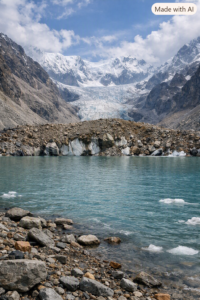
Hazards like this may reoccur. The Himalayas are warming twice as fast as the global average, degrading the permafrost that acts as the “glue” holding steep mountain slopes and glaciers together. This exponentially increases the frequency of ice avalanches and Glacial Lake Outburst Floods (GLOFs). Managed retreat to higher ground, while economically and culturally disruptive will be necessary for these populations.
Rebuilding warning networks: ICIMOD (International Centre for Integrated Mountain Development): Based in Kathmandu, ICIMOD was one of the fastest actors in predicting the risk. Through their SERVIR Hindu Kush Himalaya initiative and their specialized flood early warning systems, they monitored real-time satellite imagery and river gauge data. They issued rapid alerts regarding the swelling of major river systems (like the Koshi and Bagmati) and the high risk of landslides in vulnerable hill districts days before the worst of the flooding hit. This international NGO has spent years building community-based Early Warning Systems (EWS) in Nepal’s flood-prone Terai region and hill districts. Because they have pre-existing networks of local volunteers equipped with sirens, megaphones, and SMS networks, they were among the fastest at translating ICIMOD and government forecasts into immediate evacuation orders at the village level.
– contributed by Steve Hansch and the WHES Board
-
 World Hunger Education
Service
P.O. Box 29015
Washington, D.C. 20017 -